
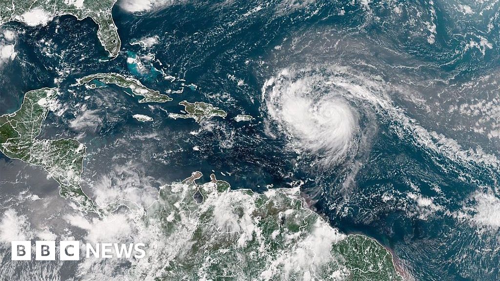
Hurricane Erin has rapidly intensified into a Category 5 hurricane, with maximum sustained winds recorded at 160 mph (260 km/h). According to Mike Brennan, Director of the National Hurricane Center, the storm underwent “explosive deepening” overnight, escalating from tropical storm strength on Friday.
The hurricane is projected to pass north of the Leeward Islands, the Virgin Islands, and Puerto Rico over the weekend. It is expected to bring up to 6 inches (15 cm) of rainfall, with associated risks of flash flooding and mudslides. Currently, forecasts indicate that Hurricane Erin is unlikely to make landfall on the mainland United States.
Rapid intensification is characterized by a storm strengthening by at least 34 mph within a 24-hour period. Erin’s winds increased from 100 mph early Saturday morning to 160 mph. Over the following week, the storm is anticipated to move northward, passing east of the Bahamas and approaching the Outer Banks of North Carolina.
Mike Brennan noted that the storm will generate life-threatening surf and rip currents along much of the east coast of the United States. Florida and mid-Atlantic states are expected to experience the most hazardous surf conditions. Bermuda may also face dangerous surf conditions and heavy rainfall due to the hurricane.
In response to gale-force winds, the U.S. Coast Guard has enacted restrictions for vessels at ports in St. Thomas and St. John in the U.S. Virgin Islands, as well as in several municipalities in Puerto Rico, including San Juan. The National Oceanic and Atmospheric Administration (NOAA) has forecasted an “above normal” Atlantic hurricane season for 2025, with an increase in the frequency of tropical storms reaching Category 4 and 5 categories attributed to global warming.
Source: https://www.bbc.com/news/articles/cdxyezqx4r5o?at_medium=RSS&at_campaign=rss